The Faroes has been a bucket-list destination for me for years, and while I love Iceland, truth be told, the Faroe Islands was the reason for this trip. We had to fly through somewhere to get there and I’ll never pass up the opportunity for more time in Iceland.
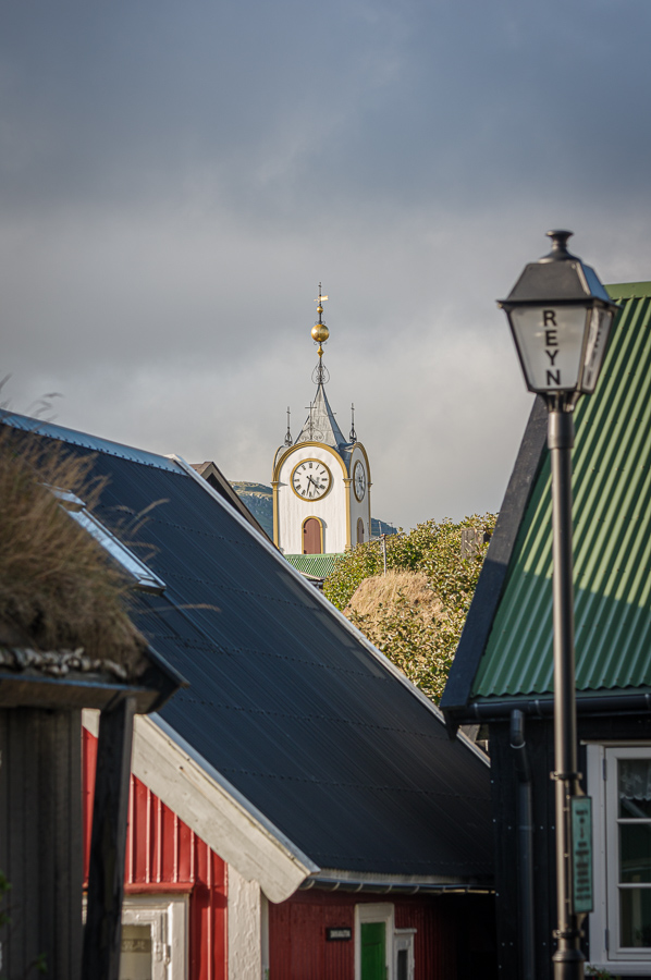
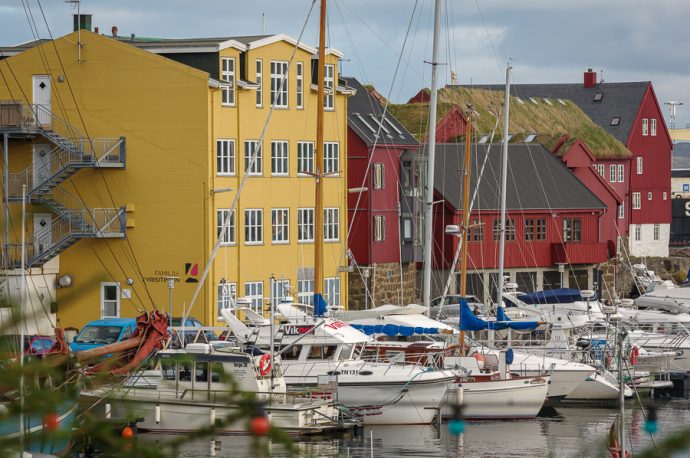
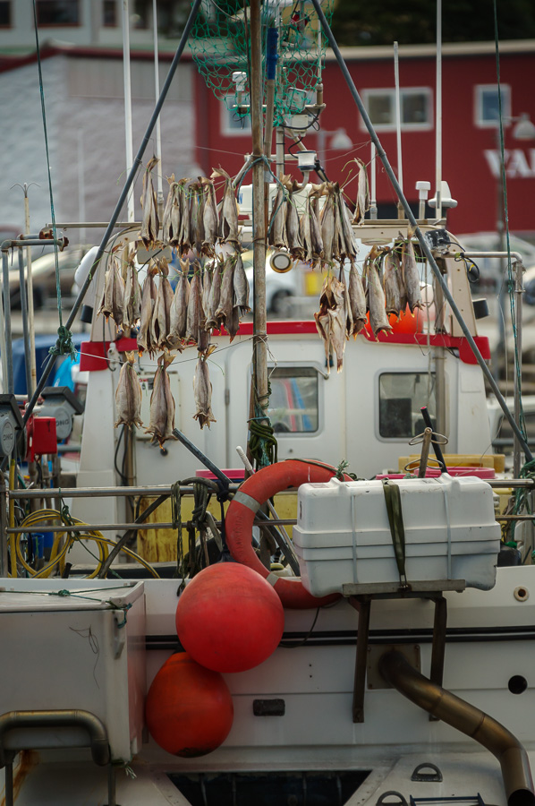
If you don’t know much about the Faroe Islands, you’re not alone. Probably the question we most received before (and after) the trip is, “where?” So, a quick primer: The Faroes are a group of islands (18) between Iceland and Norway (you can probably already tell why I wanted to go since those two are among my favorite trips ever). They are part of the Kingdom of Denmark, though self-governing since just after WWII. Fishing is the main industry and there are more sheep than people (~50K people, ~70k sheep), though tourism, pre-COVID, is increasing.
And you may start to hear more about them. Tourism is growing and they continually have tourism campaigns that get international attention. For example, Sheepview, which was their petition to Google to add Streetview to their country (Google initially declined, but all the press changed their minds).
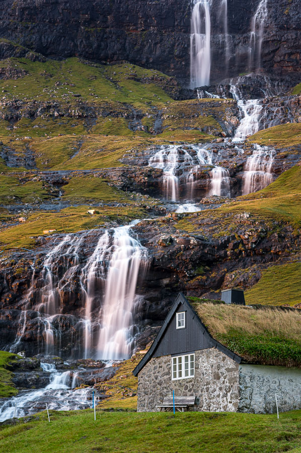
The landscapes are stunning with mountains running into the sea, and the often poor weather only adds to the dramatic views, though also making it challenging to get outside sometimes (we spent two days inside due to weather). It just made the good weather days all the more rewarding.
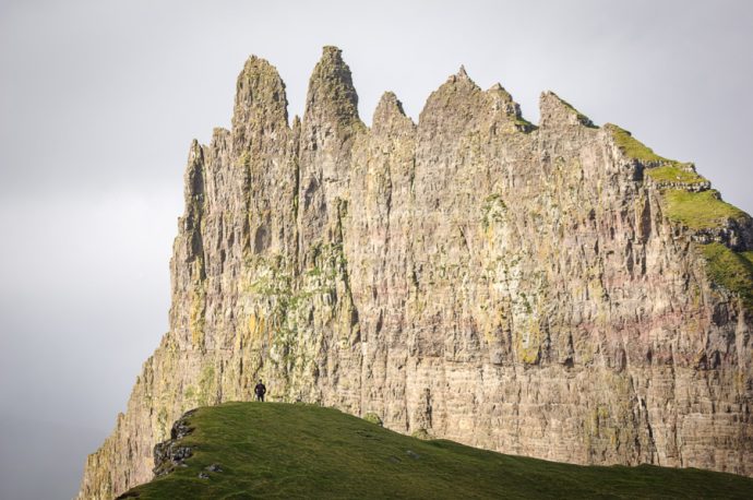
A hiker looks out towards Tindhólmur.
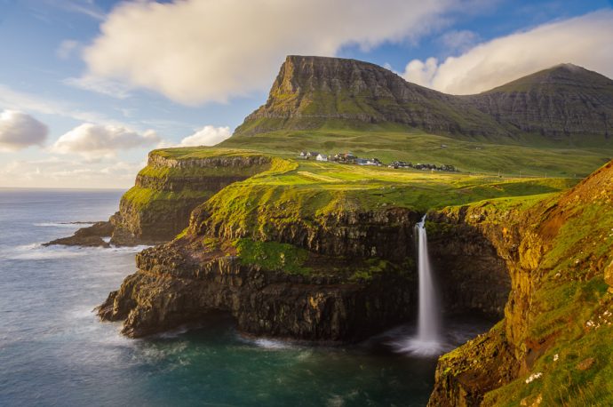
If you’ve seen only one image of the Faroe Islands, this was probably it. The Village of Gásadalur perched above Múlafossur waterfall.
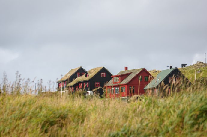
Houses in the Village of Kirkjubøur.
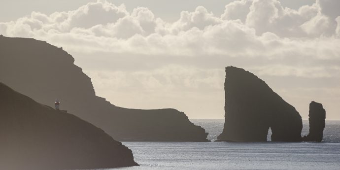
Drangarnir and Tindhólmur from the iconic little Village of Bøur.
Drangarnir from across the fjord.
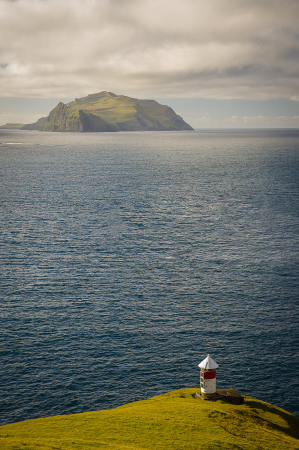
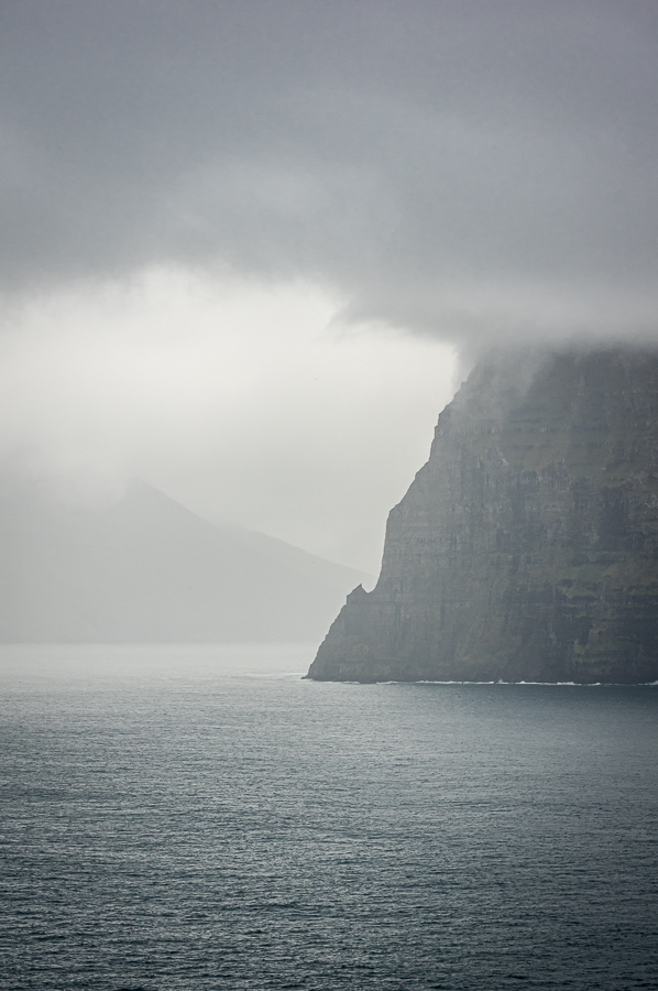
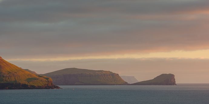
A lighthouse with the Island of Mykines in the distance.
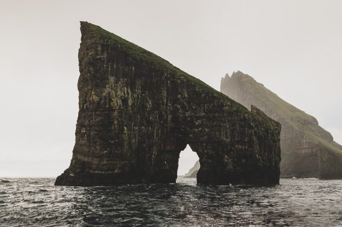
Drangarnir. We hiked all day to get to this spot and back. It was beautiful for the entire hike except the one hour we had here. Still, I sort of love the moody weather.
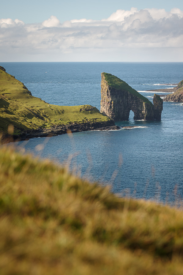
Drangarnir on the sunny part of the hike.
One of my favorites of the trip. Looking out over the fjords, in quickly changing weather, from the Village of Trøllanes on the Island of Kalsoy.This photo just summed up our experience there for me.
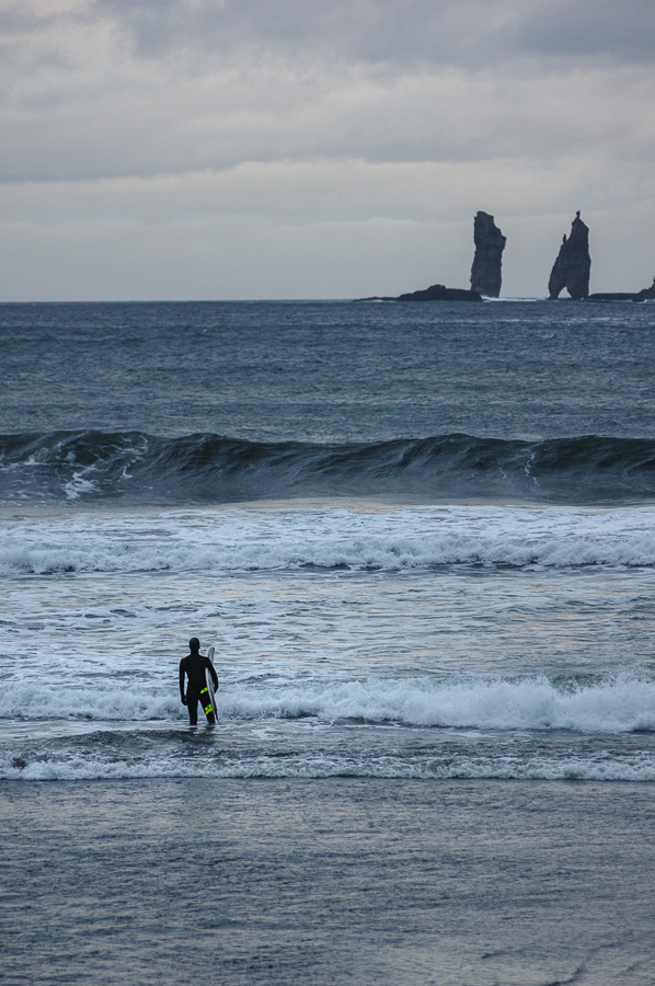
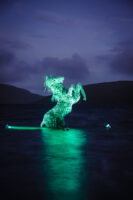
A surfer in the Village of Tjørnuvík with Risin and Kellingin in the background. See my previous newsletter/blog post on the folklore surrounding these formations.
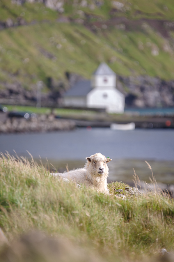
A sheep near Kirkjubøur Village with Olaf’s Church in the background.
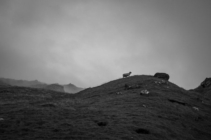
A lone sheep on a hill above Trøllanes.
The Town of Eiði on a rainy day.
The village of Saksun, glowing in the setting sun.
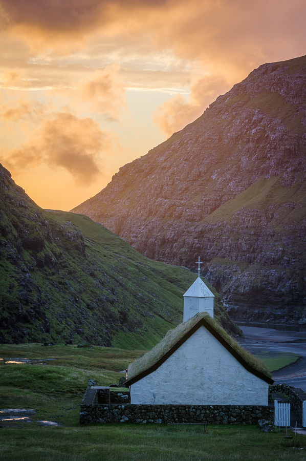
The church in Saksun at sunset.
Norðradalsvegur at sunset. It’s ok, I can’t pronounce it either.
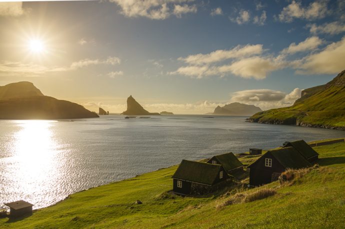
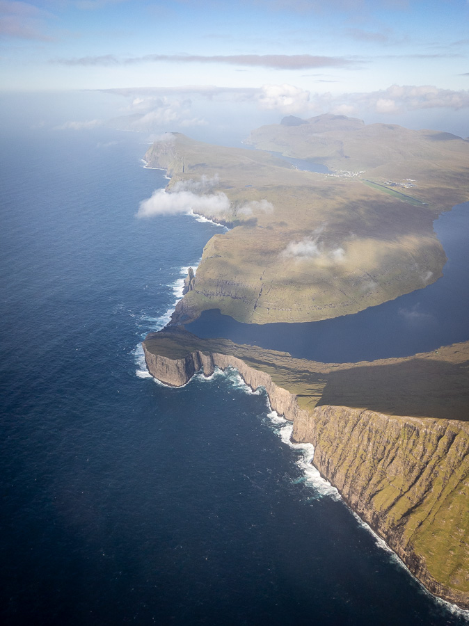
Departing. At right, the famous Sørvágsvatn Lake creates an optical illusion depending on the viewing angle. The large lake is suspended above the sea.
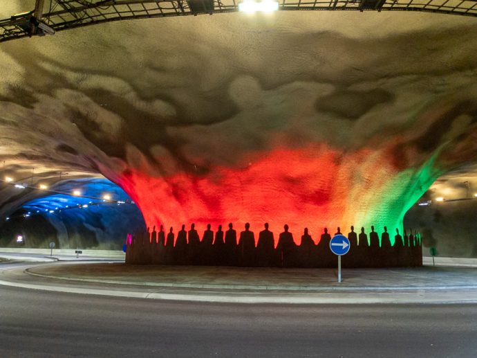
An undersea roundabout in a tunnel. Tunnels are a key way many islands are connected, in addition to the ferries.
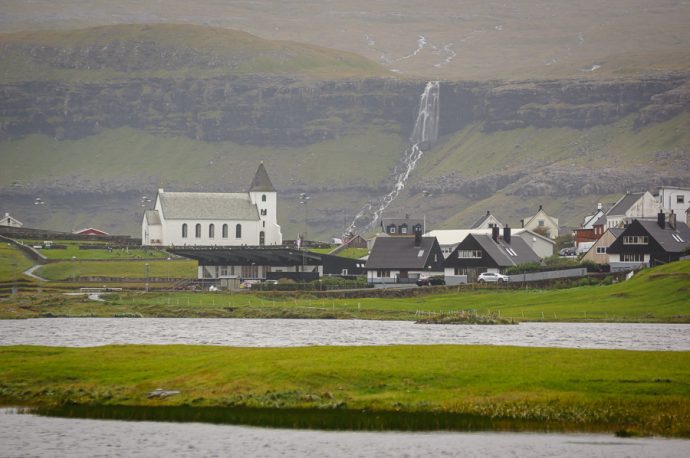
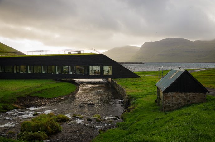
The community center/town hall in Nordragota. You can walk over the building, which also serves as a bridge between two communities.
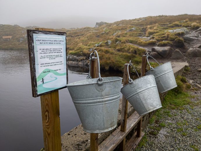
Historically, there weren’t dedicated hiking trails, but rather seldom used footpaths. With more hikers has come the need to build trails. Here, they ask hikers to carry a pail of rocks up the trail and dump where the gravel trail ends.
Wow it’s really amazing place, it’s one of my bucket list. Wish I could visit this place again,and I’m dreaming of one day I could meet a guy from this place❤️


Morocco Tours
23 Jan 2022Awsome blog!
Gaynalle Amorin
18 Feb 2022Wow it’s really amazing place, it’s one of my bucket list. Wish I could visit this place again,and I’m dreaming of one day I could meet a guy from this place❤️
Gaynalle Amorin
18 Feb 2022It’s an amazing place I’m always dreaming to visit this place…. hopefully I could meet someone from this place to invite me in Faroe Island ❤️❤️❤️